Friday, December 5, 2014

2014 – Rae Lakes Loop

2014 – Rae Lakes Loop

Kings Canyon National Park, CA – October 4-5, 2014

I could barely contain my excitement when Sarah asked me to plan a weekend backpacking trip.  Apparently 6 months was long enough for her to forget the trials and tribulations of the last 22 mile / 6k feet snowshoe extravaganza in the Sierras that ended with a cold sleeping bag instead of a warm meal. 

Our schedules permitted a three day adventure so I scoured maps and blogs to find the right trip.  The 42 mile Rae Lakes Loop in Kings Canyon National Park jumped out as the beauty was undeniable and the crowds limited in the late season.  The weather was the only wildcard: we would not attempt the hike if a large snow fell during the two week period between planning and execution.

As the trip drew closer, our three day time window condensed to two.  The Loop is eminently doable in two days, but the shortened timetable would preclude us from visiting the reportedly stunning Sixty Lakes Basin.  Fortunately no snow fell in the days leading up to our trip and we were all set for a quick shot of backcountry fun.

The drive from my house to the nearest campsite to Road’s End took about 5 hours.  We departed on Friday evening around 6PM.  By 11:30PM we unrolled our sleeping bags and set an alarm for 30 minutes before dawn to ensure we were on our feet by first light.

The morning was brisk as we arrived at the trailhead at 5k feet in elevation.  There we saw a trail runner heading out.  I quietly wondered if she planned to run the Loop and figured I would know in a few hours if we passed her again.  I have read good things about running the loop and was excited to see the terrain for myself.


The Woods Creek trail follows the South Fork of Kings River and Woods Creek for ten miles through the aptly named Paradise Valley.  The Valley was very pretty as we steadily climbed.  We followed a number bear tracks and droppings along the trail and a few deer as we made our way through the fall colors and glistening aspens.  Eventually we reached the intersection of the John Muir Trail where we turned south.  The signs brought back great memories of the summers of 2008 and 2009 when my father and I hiked the JMT.


We continued climbing as the trees disappeared and we surpassed 10k feet in elevation.  We passed multiple lakes as the afternoon continued and saw a few groups of deer alongside the trail.  Late in the day we encountered the trail runner as she worked her way back to the beginning on what she said was her first run greater than 30 miles.  Good for her!

We reached Rae Lakes and inspected the unoccupied and nicely built ranger station around 4PM.  Remarkably we seemed to have the huge lake to ourselves and situated ourselves at a terrific campsite overlooking the lake and surrounded by the towering Painted Lady, Mount Rixford, and Dragon Peaks.  We enjoyed sunset in one of the finer dining rooms in the world.  After dinner we were fast asleep in our bivvies to rest for the next day’s hike back to Road’s End.


Our wakeup alarm broke the frozen silence as we dressed while and began the rest of our two mile walk around the remaining portion of Rae Lake to Glen Pass while the sun rose.  We crested the 12k foot pass and remarked at the 360 degree views of the High Sierra and her many 14k+ peaks to the south.  From Glen Pass we began the 18 mile / 7k feet descent back to our car tracing the route of an ever expanding Bubbs Creek as it dropped through the granite canyons to the valley below.


We reached the car around 3PM to begin our drive back to the Bay Area.  Unfortunately we did not have time to revisit the famous Great Sequoias like we did as children, leaving yet another reason to return soon.  The drive out of the Canyon was a stunning reminder of why I am fortunate to live within striking distance of such commanding and varied natural beauty.


Thursday, December 4, 2014

2014 – Yosemite Valley’s North Rim via snowshoes

2014 – Yosemite Valley’s North Rim via snowshoes

Yosemite National Park, CA – April 3, 2014

The final snowstorm of the 2013/2014 winter season ended as I embarked on a two day trip with Sarah to explore Yosemite’s North Rim.  We planned to complete a 22 mile loop from our campsite at Camp 4 up to Yosemite Falls, Yosemite Point, North Dome, and then down the Snow Creek trail walking past Mirror Lake back along the Valley floor to Camp 4.  In January Dave and I completed this loop when less than a foot of snow covered a mile or two of the north-facing slopes near Indian Rock.  I suspected this snowstorm dropped a few feet of snow on the entire rim and prepared for a challenging journey on snowshoes this time around.

We arrived at a largely vacant Camp 4 with a few inches of melting snow on the ground and enough remaining daylight to explore the base of Yosemite Falls and around the mainly closed park concessions.  Visiting Yosemite in the off-season is a treat as compared to the summer months when the Valley is filled with people.  After a simple dinner at one of the restaurants, we returned to our bivy sacks at Camp 4 and settled in while the temperatures dropped into the low 20s.

Our adventure began at dawn as we marched uphill towards the nicely flowing Yosemite Falls.  Toward the top, the trail became a slippery mixture of packed snow and ice which slowed our ascent.  At the crest we admired the Falls and walked across the bridge where we met with deep untrammeled snow.  We donned our snowshoes and prepared for the big effort ahead.
 

Snowshoeing requires a much greater effort than hiking although it opens up a blank canvas of snow on which to tread.  Deep snow offers modern snowshoes great purchase with which one can ascent steep slopes which are otherwise entangled with vegetation.  We reached Yosemite Point with a few college students enjoying the freshly broken path and enjoyed a snack once reaching the overlook.

We continued on from Yosemite Point alone as the students retraced their steps back to the Valley.  We followed the edge of the Rim through four plus feet of snow and admired the views of the Valley and the stillness of the Ponderosa pine forests.  The warm sun shone brightly as we enjoyed a gorgeous day in the backcountry.

All was quiet until Sarah was unexpectedly passed by two men running in our tracks wearing only running shoes and light windbreakers.  During our 30 second conversation, I learned of their plan to ascend North Dome on their way back to the Valley floor, just like us.  With a friendly ‘goodbye’ they ran, post-holing up to their waists, making quite the scene as they bounded up and down through the deep snow. 

We loosely followed their path for a mile or so through the tight pine forest until their tracks took a sharp turn to the North.  Fairly convinced they turned the wrong direction, we continued on our own towards North Dome.  Once we reached the final approach to North Dome, my route-finding was confirmed but I wondered where they ended up as no tracks were to be found.  Hopefully they would have better luck finding the top of Snow Creek trailhead as a night in wet sneakers with limited clothing would be dangerous.

Sarah took a breather as I hurried out to North Dome to enjoy the views.  The wind howled outside of the shelter of the pines while the sinking sun reminded me that we had more hours of snowshoeing than daylight ahead of us.  We skipped a visit to Natural Arch as the sun began to drop and, just above the Snow Creek trail, crossed the tracks of the intrepid runners confirming that we were the last people on the Rim.  We watched the setting sun’s pink glow on Cloud’s Rest and Half Dome as we descend the steep trail into the Valley.

The short winter day and long slog on snowshoes meant we covered the last 6 miles and ~3 hours by headlamp as the temperatures quickly dropped.  We made our way toward our campsite under the stillness of the crisp winter night while the bright moon and stars illuminated the Valley’s granite walls. 

 
Once we arrived back to Camp 4 at nearly 10PM we faced the unfortunate reality that all of the limited use concessions had closed for the evening therefore depriving us of the time honored food binge that follows a huge day in the backcountry.  With nothing to do but wait until morning light, we climbed into bivvies and listened to our stomachs growl.

The next morning brought sunshine and two hungry travelers to the park cafeteria.  There we devoured breakfast before a short hike and drive back to the Bay Area where warmer weather awaited us.
 
Another wonderful adventure in the Yosemite snow!


Tuesday, October 7, 2014

2014 - Crystal Springs Trail Half Marathon

2014 - Crystal Springs Trail Half Marathon

Woodside, CA - August 9, 2014

I set aside structured training and race ambitions this year to focus on my growing family.  Despite a
lack sleep, and training, I decided to mix things up and race the Crystal Springs Trail half marathon.  The event fit the bill perfectly as the race is pretty, requires only 2 hours away from a busy home, and accepts last minute entries.    

The course is largely contained within Huddart Park and meanders up Kings Mountain towards Skyline Boulevard.  I was happy to run the cool and shady course on an otherwise hot and sunny summer morning.  I seeded myself near the front of about 170 racers and simply hung on as the course narrowed from a wide field to a fire road.

As the fire road turned to single-track and the gradient increased, the pace of the race dropped.  The course steadily climbs soft single-track through redwood forests for the first half before looping back down to the start/finish line.  I enjoyed my position and guessed I was somewhere in the top ten.  A spectator near the top of the mountain commented that I was actually in 4th place overall and closing on the next two racers.  The race was on!

Downhill running is not my strong suit but I pushed my pace to the brink.  I reeled in the high school XC runner immediately ahead of me to move into 3rd place overall.  Unfortunately, my lead evaporated once the course flattened.  He caught and ultimately passed me. Trodding a fine line between running fast and blowing up, I struggled to keep him within 30 yards.

I continued to chase for a few minutes but the gap persisted.  I decided to mount a last attack once within the last mile of the race.  I closely watched the distance traveled on my Garmin watch slowly tick upward as the time to go for glory drew closer.  Unfortunately, just before 12 miles, my plan failed as I heard the unmistakable commotion of the finish line.  Confused, I rounded a bend to watch the XC runner cross the finish line.  Apparently the course and my watch did not agree on the true distance of the course!

I finished in 4th place as the 3rd place male, 19 seconds behind the high school XC runner.  I thanked him for the friendly competition and a fun challenge.  The fastest woman of the day finished 14 seconds ahead of him as the 2nd place overall finisher.  All in all a close race.

Before I knew it I was back home playing with my family and enjoying what remained of the Saturday morning.  There are few better ways to begin a weekend than with the thrill of friendly competition on beautiful trails.

Results: 1:41:42 (official: 7:46/mi; Strava: 8:28/mi)
http://www.coastaltrailruns.com/cs_smmr_results_14.htm

Thursday, January 2, 2014

2013 - Big Sur: McWay Falls to Partington Cove and Back

Julia Pfeiffer Burns State Park, CA – December 28, 2013

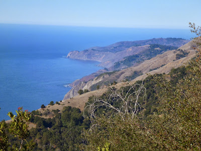
I spent the last Saturday of 2013 hiking in the Big Sur region of California’s Central Coast.  The steep slopes of the Santa Lucia mountain range end with sheer cliffs dropping directly into the Pacific Ocean, creating a gorgeous setting ripe for exploration. 


The warm, clear day started along Highway 1 near McWay Falls.  McWay Falls, and the remaining foundation from the “Waterfall House” overlooking the Falls, is spectacular.  I read the history of the Park and its benefactors while enjoying the spectacular view from where this mansion once stood.  I strongly encourage anyone passing through the area to see McWay Falls as it is easily accessible from the highway.
 

From the Falls area, I ascended the steep Ewoldsen Trail through one of the southernmost groves of towering coastal redwood trees.  The forest was tranquil before entering a hot chaparral environment which offering spectacular views of the blue ocean and white rocks way below.  I traversed a steep slope via the seldom used Waters Trail before arriving at an unmarked trail ascending towards the site of the Alta Vista cabin. 
 

The Alta Vista cabin, or what is left of it, captured my imagination.  The cabin and barn were destroyed by the Basin Complex Fire when it swept across the area in 2008.  5 years after the fire, only the foundation, root cellar, and impeccable view from this 1932 homestead remain.  The site is ~2,500 feet above the sea and reachable only by foot or horseback.  This site offered its inhabitants a tremendous place to enjoy.  Click here for pre-fire photos and history.
 

More striking than the site of the cabin is the power of wildfire.  After navigating through the dense brush that has grown back around the cabin site, I followed the Tan Bark Trail into another impressive stand of redwoods.  The redwoods bear fire scars no less than 60 feet above the ground.  I can only imagine what this area would have looked like during the fire…

 
The next stop was Partington Cove where I descended to the ocean to eat lunch in the sun and watch the waves crash.  After lunch I visited the a few of the vantage points on the rocks above the sea before following the Partington Creek back up the mountain.  Once I re-crossed the Waters Trail, I descended the other portion of the Ewoldson Trail that remains under construction post the Basin Complex Fire.  There I confirmed my suspicion that the redwood boards for trail bridges are hewed from on-site redwoods.  Someday I hope to catch the builders in action and see the saws they use to cut the boards so elegantly.
 

The day ended admiring McWay Falls after 18 miles of hiking and 5,300 feet of climbing.  This was another wonderful day on the trails in a region I look forward to exploring more.
 

Thursday, December 26, 2013

2013 - Yosemite in the fall

Yosemite National Park, CA – December 7-8, 2013

An ever increasing force pulled me towards the Sierras after a fall season filled with home improvement projects.  The sensation peaked on Thanksgiving weekend when Verneta, Susan and I visited the Lick Observatory on Mt. Hamilton.  From there I saw the Sierras calling me to come and play. 

It was time to get to the mountains, and fast. By Tuesday a cold front brought a severe blast of Arctic air to California. The forecast called for precipitation to begin on Friday evening and drop over a foot of snow in the Yosemite Valley by Saturday evening.  I purchased snow chains on my way home from work on Friday night and packed sandwiches for a fun solo adventure (Yosemite requires four wheel drive vehicles to carry chains). 

I was so excited for this trip that I hit the road at 3:45AM Saturday morning.  Travelling early in the morning was ideal as I had the highways to myself.  I took route 140 along the Merced River due to its relatively low elevation approach to the park and encountered snow around 1,000 feet.   Despite slippery roads for the final hour, I reached the entrance before 8AM.  I was alone to take in the spectacular views that welcomed me during a brief break in the storm.


After capturing a bunch of photos, I started my snowshoe through a foot of snow and heavy snow showers.  I climbed the old wagon path from Bridalveil Falls to Stanford Point.  Unfortunately, the clouds that brought the powdery snow blocked the spectacular views that normally reward this 6 mile / ~3,700 foot climb from the Valley to the Rim.  View or no view, I was happy to be there and thoroughly enjoyed breaking my own trail and seeing only deer and bear tracks during the six hour journey. I did a post-hike drive through the Valley to watch the sunset before heading down to El Portal for the night.


The next morning I was back on the trail under crisp blue skies and brisk 14 degree temperatures.  The Valley was exceedingly pretty with powdery snow covering the ground and trees.  I expected crowds, but again found solitude and unbroken trail while I followed Tenaya Creek past Mirror Lake.  After crossing the bridge I started up the Snow Creek trail to a vantage point well above the trees.  My climb yielded supreme views of Cloud's Rest, Half Dome, Sentinel Dome and the aftermath of the Ahwiyah Point rock fall.  I sat down to take it all in before meandering along the valley floor and crossing more bear tracks before reaching the car.

I finished this fun weekend with a burger and fries at the Priest Station Cafe.  I felt fortunate to arrive home just in time for a fun evening hike in the Santa Cruz Mountains, sans snowshoes, with Susan.
 

Sunday, November 3, 2013

2013 - Trans Pyrénées Cycling Trip

Trans Pyrénées; Sunday August 25 through Saturday August 31, 2013

My dad and I ventured back across the Atlantic for our second trip with Thomson Bike Tours.  This time we rode the trans-Pyrénées route, which spans the length of the mountain range from the Mediterranean Sea to the Atlantic Ocean.  Our journey began in the town of Sitges, just south of Barcelona in Spain.  After a one day warm-up on the famous Rat Penat, we spent six days riding through the Pyrénées on our way to the seaside town of Hendaye, France.

There is nothing better than riding your bike all day through magnificent countryside and alpine towns before bingeing on French and Spanish food in the evenings.

The ride profiles, embedded below, detail our journey.   In seven days we rode 513 miles and climbed 56,955 vertical feet.  That's a strong week on the bike...


Friday, September 6, 2013

2013 - High Cascades 100

High Cascades 100; Bend, OR - Saturday July 20, 2013

The Tahoe Trail 100k mountain bike race last summer reignited my excitement for off road riding. Last fall I traded in my 14 year old rig for a full suspension 29er and dove in to the many great trails the Santa Cruz mountains have to offer. I decided to take some time off from triathlon after a 5 fun year stint and do an off road race in 2013. My race selection criteria was simple: the race's distance must be 100+ miles and within a one day drive of NorCal.

When I found the High Cascades 100 in Bend, OR I immediately marked my calendar for the Jan 1st registration. The race stood out for a few reasons. First, neither Susan nor I had ever been to Oregon and we were both itching to check it out. Second, the race is small and family run. I was excited to get away from the Ironman-esq big race productions that have lost their soul to marketing. Third, the race features 85+ miles of single track and is one huge loop. If I wanted to race pure mountain bikers on a route that would be nearly impossible to plan myself, this was the one!

I stowed the mountain bike around the holidays before dusting it off at the beginning of March after a decent winter of road miles. I spent the next four months juggling home improvement work while sneaking in trail miles whenever I had extra energy. I really came to appreciate the glorious absence of cars and presence of animals on the trails while quickly recognizing the importance of bike handling skills at speed. I had a few isolated brushes with the ground but fortunately nothing too serious!

The HC 100 was the weekend immediately following the Death Ride. In an ideal world I would have had a additional week in between the two, but c'est la vie. I could never choose just one and am more serious shout fun than results. Susan and I left work late on a Thursday afternoon for our three day weekend up in the Cascades.

Bend is 500 miles north of our house and the drive up there is pretty fantastic. First, you head north through the Central Valley before coming face to face with Mount Shasta (gorgeous!). After Shasta, it is all big woods of Ponderosa pines. This was real logging country with miles and miles of land and super clear streams. Eventually the town of Bend appears with views of volcanic Mount Bachelor and the chilly Deschutes river running running through it.

We arrived just in time for check in and the pre-race talk. The heat warning for the high-nineties temperatures and blinding dust did not scare me coming off of a series of heat waves and perpetually dusty trails back home. I was nervous about the technical nature of the course though and took a keen interest in the tight, curvy, and rocky conditions (I packed my pads). This race would require all of my skills and promised to be just the day long adventure I was looking for. I needed to finish under 15 hours to make it official and planned to do just that while not crashing and ruining my planned hike around Crater Lake the following day with Susan. The pressure was on!


Post check in we hit the river for relief from the triple digit heat. I soaked my legs while Susan showed off by swimming. It was another gorgeous day to be alive with swimmers, paddle boarders, kayakers, and dogs alike enjoying the sun and fun. We ended the party with some pizza and stroll around the downtown area before heading back to our room next to the start line.

My 4AM alarm came quickly. The pre-dawn air was warm and after a few opening words we we off for a 10 mile neutral road start behind the director's truck as he led us up the to mountains. Once we hit the dirt it was game on with deep sand on the ground and thick dust in the air. I followed the director's advice and wore a bandanna to keep my lungs clean. This tactic served me well and is a trick I plan to use again.

The route was (mostly) cut just wide enough for me to fit my handlebars through. The sides of the trail were littered with Ponderosas both big and small, standing and fallen in a menacing patchwork. The surroundings strongly discouraged me from overcooking any of the endless turns. 20 minutes into things I saw the pro who has dominated the race in years past walking out with a broken collarbone. I backed off a bit and reminded myself how awesome it will be to hike Crater Lake in one piece!

The terrain was a lot of fun. The trails were seemingly endless with no straight lines to be found. We passed high alpine lakes and meadows with views of snow-capped volcanic mountains. I loved the loop and couldn't believe just how much riding Bend has to offer as many trails crossed our path all along the way. This is big country ripe for exploration!!

Just under 12 hours after I started, and a little over 11 hours of actual pedaling, I rolled back into Bend and finished the race. I was basically alone on an epic ride for the last 4-5 hours and enjoyed the phenomenal scenery and BMX-type riding with periodic water and peanut butter and jelly refills. I made it through without any crashes and sharpened my technical skills. While I would have been more "competitive" on a less technical course that emphasized fitness over skills, I was pretty psyched for the experience and to see what great trail riding is like. This was both my longest day on a bike and the most engaging. There was no margin for error so spacing out was not an option.

Susan and I split my post race veggie burger and pasta before jumping in the car to head south to Crater Lake. We hit the Lake just in time to watch the sunset and again remind ourselves how lucky we are to explore gorgeous places like this. The next morning we hiked around the Lake and traded stories from our hiking/biking adventures the previous day before we jumped in the car to head back to CA with another unforgettable weekend in the books!


An alpine lake near Mt. Bachelor 

Crater Lake